Manali to Spiti Valley: Complete Route Guide 2026
190 km, one pass at 4,590m, zero ATMs. Atal Tunnel vs Rohtang, Gramphoo junction, Batal, Kunzum Pass, Chandrataal detour, and the fuel gap explained.
Quick route stats
Manali to Kaza (main town, Spiti Valley): 190-200 km via Atal Tunnel and Batal. Altitude range: Manali 2,050m to Kunzum Pass 4,590m to Kaza 3,800m. Road surface: paved from Manali to Gramphoo, gravel and rough dirt from Gramphoo to Losar, mostly paved from Losar to Kaza. Season: June to October. Kunzum Pass closes after first heavy snowfall.
Fuel: last reliable pump is Manali (or Keylong). Next is Kaza. No fuel at Batal. ATMs: zero between Manali and Kaza. Carry Rs 5,000 to Rs 8,000 cash per person minimum.
No fuel station and no ATM exist between Manali and Kaza. Fill your tank and withdraw cash before leaving Manali.
Rohtang Pass or Atal Tunnel?
Rohtang Pass (3,978m) is the old route over the mountains. Atal Tunnel (8.9 km, opened October 2020) bypasses it entirely. Both get you to Gramphoo junction where the Spiti road turns left.
Rohtang: permit required for non-HP vehicles (Rs 200, apply 3 days ahead at rohtangpermit.nic.in). Diesel vehicles only beyond Marhi. BRO opens the road usually in late May or early June. July-August can mean 4-5 hours for the 51 km crossing.
Atal Tunnel: no permit, 15-20 minutes through, open year-round, all vehicle types allowed. Saves 46 km and at least 1-1.5 hours. For the Spiti run, the tunnel is the practical choice.
Stage 1: Manali to Gramphoo Junction (35 km, 1 hour)
Fill your fuel tank completely in Manali. Withdraw all the cash you need. Download offline maps for Lahaul and Spiti. Drive to the Atal Tunnel South Portal (20 km), through the 8.9 km tunnel, then 5 km to Gramphoo (3,290m).
At Gramphoo the road forks: left (NH-505) for Spiti Valley, right for Keylong and Leh-Ladakh highway. The sign is small. I nearly missed it on my 350cc bike in September.
The Gramphoo junction sign is modest. Slow down and watch for the left fork to Spiti.
Stage 2: Gramphoo to Batal (55 km, 3-4 hours)
This is where Spiti reveals what it is. The road follows the Chandra River and the surface goes from tarmac to gravel to rocks within 10 km. Plan 3-4 hours for this 55 km section.
You will pass Chhatru (3,310m) with a basic bridge and sometimes a dhaba. In late July and August, river crossings near Chhatru can be knee-deep from glacial melt. No fuel, no medical facilities, no phone signal once you leave Gramphoo.
Stage 3: Batal (3,960m)
Batal is not a town. It is a handful of tents and one permanent structure: Chacha Chachi dhaba. The dal is Rs 60 for a full plate. The dhaba operators will tell you how many bikes came through today and whether the road to Kunzum is clear.
No fuel at Batal. No ATM. Your tank needs to carry you from Manali to Kaza (200 km). Most 150-200cc bikes with standard tanks can do this; very small-tank bikes should carry a 3-5 litre spare can from Manali.
The Chandrataal detour (worth it)
The turnoff to Chandrataal (Moon Lake) is about 6 km before Kunzum Pass, at Batal. The lake sits at 4,300m, roughly 14 km from the main road on a narrow track. Camping is available at the lake perimeter (Rs 800-1,500 per tent including meals).
I strongly recommend an overnight at Chandrataal if your schedule allows. Breaking the Manali-Kaza drive into two days, with Chandrataal as the midpoint, is better for altitude acclimatization and the lake itself is one of the most beautiful sights in the entire Himalaya.
Stage 4: Kunzum Pass (4,590m)
The 20 km from Batal to Kunzum Pass is the roughest section of the entire route, unpaved and rocky. Allow 1.5 to 2 hours. The Kunzum Mata temple sits at the summit. Stop, rest, hydrate, and do not rush the descent.
From Kunzum, it is 28 km down to Losar (the first Spiti village, 4,079m) and then 60 km on mostly paved road to Kaza. The descent from Kunzum into Spiti Valley, when the wide grey valley opens up below you, is the moment the entire drive was building toward.
Stage 5: Losar to Kaza (60 km, 1.5-2 hours)
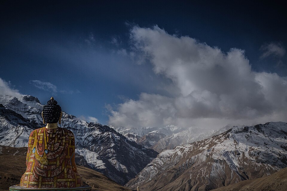
From Losar the road improves significantly. Kaza (3,800m) is the district headquarters of Spiti with the only reliable ATM and fuel station in the valley. Fill fuel, withdraw cash, and use the internet while it works.
Frequently asked questions
How far is Manali to Spiti Valley (Kaza)?
Approximately 190-200 km via the Atal Tunnel route. The drive takes 8-10 hours in a single push.
Is the Manali to Spiti road open in June?
Yes, in most years. Kunzum Pass typically opens in late May or first week of June. Check BRO announcements for confirmed dates.
Do I need a permit for Manali to Kaza?
No permit needed via Atal Tunnel. Rohtang Pass route requires an online permit (Rs 200 for non-HP vehicles). No separate Spiti permit for Indian nationals on the Manali side.
Is there fuel between Manali and Kaza?
No confirmed fuel station exists between Manali (or Keylong) and Kaza. Fill your tank fully in Manali.
What is the altitude of Kunzum Pass?
4,590m above sea level. It is the highest point on the Manali to Kaza route.
Can I do Manali to Kaza in one day?
Yes, starting by 5-6 AM and skipping Chandrataal, arriving Kaza between 4-6 PM. But the two-day plan with a Chandrataal overnight is better for most people.
What is the best time for the Manali-Spiti route?
September: dry roads, rivers at lowest, clear skies, 12-18C at Kaza.
Last updated: May 2026