Monsoon travel: which mountain routes to avoid
Landslide-prone zones, BRO repair schedules, and safe alternatives during July–September.
August 2023. I had left Dehradun at 5:30 AM heading for Guptkashi, which meant taking NH-7 through Rishikesh, Devprayag, Srinagar (Uttarakhand), and Rudraprayag before turning onto NH-107. The forecast said overcast with intermittent showers. I had made this drive a dozen times.
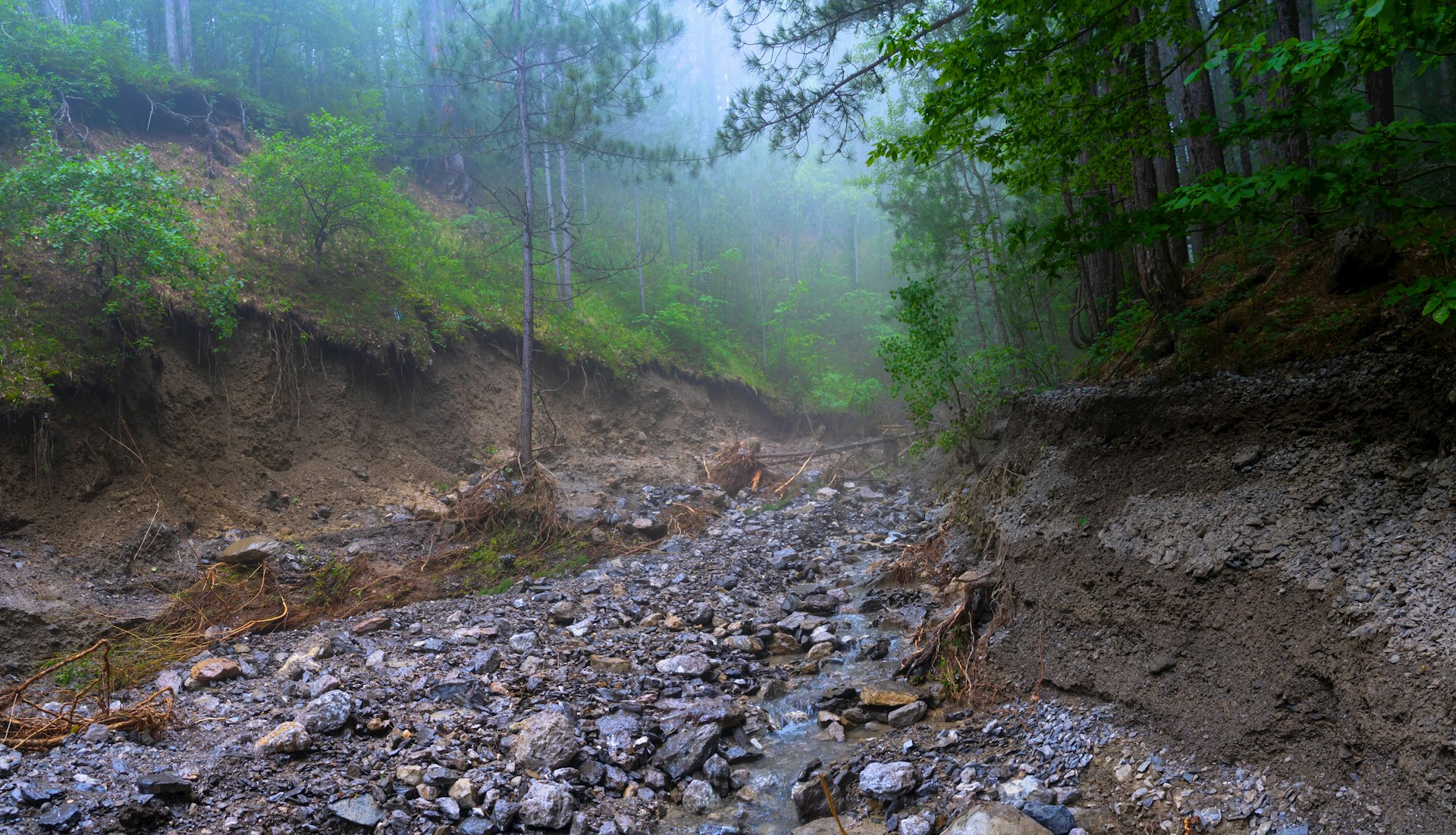
Somewhere around Kund village, about 30 km past Rudraprayag on NH-107, the road stopped. Not in the slow, gradually-tapering way where you see brake lights and inch forward for twenty minutes. It stopped completely. A slab of hillside had come down across the road in the night, taking maybe 40 meters of tarmac with it.
The BRO team was already there. They said six to eight hours, maybe more. There was one dhaba within walking distance, it ran out of chai and Maggi by noon, and my phone had one bar that disappeared entirely whenever more than two people tried to call. I turned around at 2 PM after waiting five hours.
That is the actual risk of monsoon mountain travel. Not just rain. The risk is that you get locked between two points with no food, no network, no toilet, no clear timeline, and a car that is slowly getting lower on fuel. This guide is about which routes carry that risk, and what to do instead.
How monsoon works differently in the Western Himalayas
The Indian monsoon comes from the Bay of Bengal and travels northwest. By the time it reaches Uttarakhand, it is still fully loaded - which is why Uttarakhand gets about 1,500 to 2,000mm of rain annually and July through early September is unambiguously dangerous on mountain roads. But by the time the monsoon gets further west into Himachal Pradesh and Jammu and Kashmir, it is significantly weaker. Shimla gets around 1,100mm annually. Leh gets about 100mm.
Routes in Uttarakhand - Kedarnath, Badrinath, Gangotri, Yamunotri - sit in one of the most rainfall-intensive corridors in the country during July and August. Routes in Spiti Valley and Ladakh receive less rainfall, but face flash flooding in narrow gorges, snowfall on passes at 4,500m+, and roads not designed to handle significant water.
The monsoon reaches Uttarakhand around June 15 and typically retreats by September 15. That is the core danger window.
What both regions share is that the mountains are geologically young and unstable. A road that was perfectly stable in June can have a 50-meter gap in it by July 15.
Rishikesh to Kedarnath (NH-7 and NH-107)
NH-7 from Rishikesh to Rudraprayag - roughly 140 km - is generally manageable in monsoon. The road runs along the Ganga and its tributaries, the gorge is wide enough that landslide debris rarely covers the full road.
Everything changes at Rudraprayag when you turn onto NH-107 toward Guptkashi.
The 50 km from Rudraprayag to Guptkashi is one of the most consistently blocked stretches in Uttarakhand during peak monsoon. Kund village, Phata, and several unnamed slip zones between them are active every single season. Debris volumes can be large - 500-tonne rock-and-earth falls that take BRO machines 24 to 72 hours to clear.
My recommendation: if you are planning Kedarnath in July or August, budget at least one full extra day as buffer at Rudraprayag or Guptkashi. Do not plan travel from Dehradun to Kedarnath in a single day during this period.
The Rudraprayag to Guptkashi stretch on NH-107 is one of the most landslide-prone road sections in India during monsoon. Budget a full buffer day.
Rishikesh to Badrinath (NH-7 toward Joshimath)
The Langsi stretch, roughly between km 180 and km 200 from Rishikesh, is a historically active landslide area. Birahi to Nandprayag is another high-frequency blockage zone.
Vishnuprayag, about 12 km before Joshimath, saw significant road damage in 2021 and again in 2022. The Joshimath land subsidence that began in late 2022 has stabilized but the area remains under observation.
The Badrinath route is generally considered slightly more maintainable than the Kedarnath route because the Alaknanda gorge is somewhat wider. But slightly more maintainable still means active closures during July and August.
Rishikesh to Gangotri and Yamunotri
The 100 km from Uttarkashi to Gangotri is a consistent problem in July. The Bhatwari to Gangotri stretch - roughly 60 km - is narrow even by Himalayan standards, passes through dense forest on highly unstable terrain.
For Yamunotri, the road through Barkot to Janki Chatti has its own problems, particularly around the river crossings below Hanuman Chatti.
Practical advice: plan Gangotri and Yamunotri for either early June (before peak monsoon) or after September 15.
Manali to Leh (NH-3/NH-21 via Rohtang)
The Atal Tunnel has eliminated the seasonal unpredictability of the old Rohtang surface road for the first section. But beyond the tunnel, the road descends into the Lahaul Valley toward Keylong, Jispa, and then climbs to Baralacha La at 4,890m.
The Bhaga valley between Darcha and Patseo is the highest risk section. Flash floods from tributary streams can wash away road surface entirely. Baralacha La itself is snowed on regularly through July.
Most travelers who do Manali-Leh in July do so successfully. But plan an extra buffer day at Keylong or Sarchu.
Manali to Spiti via Kunzum La
This is the highest risk route on this list. Kunzum La at 4,551m is open from roughly June to October. The 65 km from Batal to Kaza is unpaved, passes through extremely remote terrain with no mobile signal, no habitation, and no fuel.
The safer approach to Spiti in monsoon is from Shimla via Kinnaur (NH-5), but that route has its own hazards. There is no truly safe way into Spiti in July and August.
Route risk comparison table (July-September)
| Route | Risk Level | Most Dangerous Stretch | Typical Blockage | Safe Window |
|---|---|---|---|---|
| Rishikesh to Kedarnath | High | Rudraprayag to Guptkashi (50 km) | 12-72 hours | Oct-Nov, May-Jun |
| Rishikesh to Badrinath | Moderate-High | Langsi, Birahi-Nandprayag | 6-48 hours | Oct-Nov, May-Jun |
| Rishikesh to Gangotri | High | Bhatwari to Gangotri (60 km) | 6-36 hours | Oct-Nov, May-early Jun |
| Rishikesh to Yamunotri | Moderate-High | Hanuman Chatti crossings | 4-24 hours | Oct-Nov, May-Jun |
| Manali to Leh | Moderate | Bhaga valley, Baralacha La | 12-36 hours | Jun (early), Sep-Oct |
| Manali to Spiti via Kunzum | Very High | Batal to Kaza (65 km) | 24-72+ hours | Jun-early Jul, Sep-Oct |
| Shimla to Spiti via Kinnaur | High | Wangtu to Pooh (Sutlej) | 24-48 hours | Late Sep-Oct, May-Jun |
| Srinagar to Leh via Zoji La | Moderate | Zoji La, Sonamarg valley | 12-48 hours | Late Sep-Oct |
How to check road status before you leave
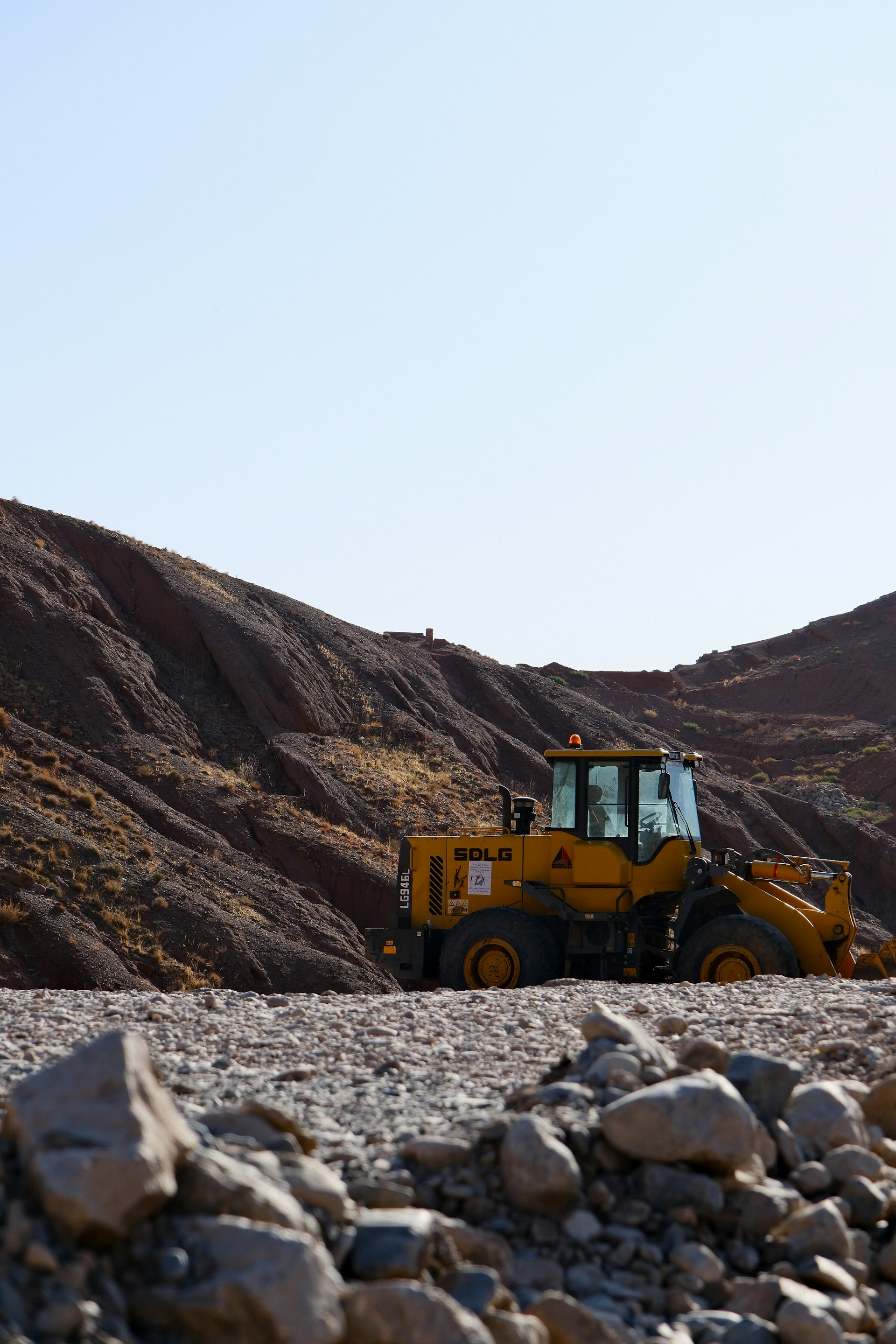
BRO machinery on a priority clearance - response times of 24 to 72 hours on main routes
This is not optional. Check road status the evening before you leave and the morning of departure.
What to do when you get stuck
The psychological reality of a mountain road blockage is that the first hour feels manageable and hours three through seven feel significantly worse.
The most useful thing you can do before a monsoon mountain drive: fill the tank completely, download offline maps, carry food and water for 24 hours, and tell someone at your destination what time you left and which route you are taking.
Routes that remain passable in monsoon
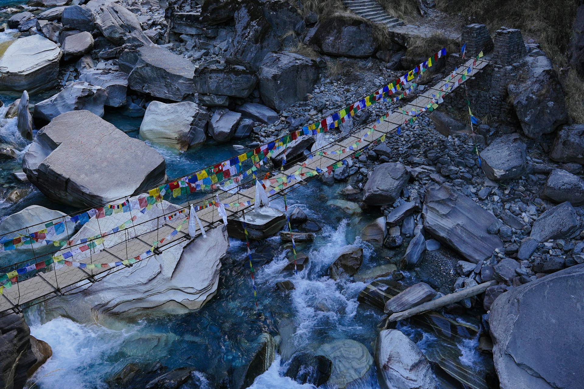
Mountain river crossings during monsoon - water levels can rise within hours
No mountain route in India is categorically safe during peak monsoon. Some carry substantially lower risk.
Frequently asked questions
Is Manali to Leh safe in July and August?
It is operationally open but not risk-free. The Bhaga valley section and high passes above 4,500m can close with 12 to 36 hours notice. Plan an extra buffer day in Keylong or Sarchu.
Which is safer in monsoon: Manali-Spiti or Shimla-Kinnaur?
Neither is genuinely safe in peak monsoon. Shimla-Kinnaur via NH-5 is generally preferred because it avoids Kunzum La at 4,551m. The Wangtu-Pooh section is dangerous but BRO access is somewhat better there.
How do I check if the Kedarnath route is blocked?
Call PWD helpline 1800-180-4145 the evening before. Check uttarakhand.gov.in road status portal. Ask at your hotel in Rishikesh or Devprayag - local drivers monitor conditions closely.
What should I carry for a monsoon mountain drive?
Food and water for 24 hours, fully charged power bank, offline maps, rain gear, warm layers, torch, jumper cables, first aid kit, and cash. ATMs on mountain routes are often offline during rain events.
Will BRO clear the road while it is still raining?
BRO crews work in all weather on priority routes if the active slide risk has subsided. On actively sliding slopes, clearance begins once the main flow stops, which can be hours after rain eases.
Can I do Gangotri in monsoon if I start early?
Starting at 4 to 5 AM from Uttarkashi helps. But the Bhatwari-Gangotri stretch is dangerous from cumulative rain over the previous week, not just rain that day. A clear morning after a week of heavy rain is still high-risk.
Is Rohtang Pass always closed in monsoon?
No. It closes for 1 to 3 days after heavy snowfall events, multiple times per month in July-August. The HP government also restricts vehicle numbers when open. Check himachal.nic.in.
If I get stuck on Manali-Leh, where is the nearest help?
Between Manali and Keylong: Rohtang rescue posts. Between Keylong and Sarchu: very limited. Between Sarchu and Leh: army checkpoints at regular intervals. BRO emergency number: 1800-180-3474.
Last updated: 2026-05-22