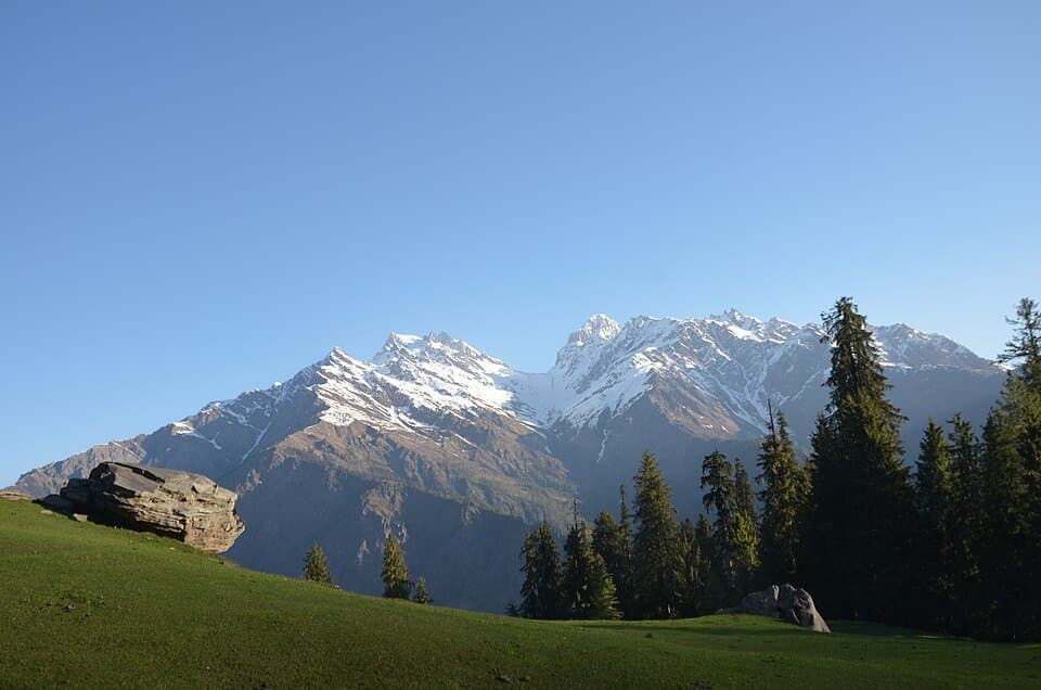
Kasol makes more sense when it is treated as a small mountain base rather than a complete holiday in one crowded market. It sits beside the Parvati River in Kullu district, with Manikaran farther up the road and several village walks and trekking corridors branching through the valley. Cafes and backpacker culture are part of the scene, but they are not the whole place. Local homes, orchards, temples, a major Sikh pilgrimage centre and a powerful river all share the same narrow geography.
The practical challenge is not finding a list of places to photograph. It is building a trip that respects mountain roads, uncertain weather, religious spaces and the limits of a traveller's fitness. A plan that works in a dry shoulder-season week may be unsuitable after heavy rain or snow. Bus times, taxi prices, trail access and accommodation availability can change; confirm them close to travel instead of treating a screenshot as a timetable.
This guide separates the decisions that are often mixed together: where to stay, whether to add Manikaran, what a Kheerganga trek involves, when to turn around and how to avoid putting pressure on the valley. It does not promise a permanently open trail or a fixed fare. Use it to shape the trip, then check current transport and trekking instructions with Himachal Pradesh authorities and responsible local operators before departure.
Decision board
Choose the right Parvati Valley base
The best base depends on the purpose of the trip, not on which village is most fashionable online.
| Decision | Kasol | Manikaran | Upper-valley villages |
|---|---|---|---|
| Best for | Food, supplies and first night | Pilgrimage and hot-spring visit | Quieter stays and trail access |
| Main trade-off | Weekend traffic and noise | Pilgrim crowds and limited space | Fewer services and harder transfers |
| Transport | Most straightforward | Short onward road trip | Depends on road and local services |
| Good stay length | One or two nights | Half day or one night | One or more nights if access is confirmed |
Decide what kind of Kasol trip you actually want
A good plan starts with one primary purpose. A relaxed valley break, a Manikaran pilgrimage visit and an overnight mountain trek place different demands on time, clothing and transport. Trying to fit all three into a rushed weekend usually means spending the trip in traffic or walking after dark.
For a low-effort visit, use Kasol as a base, walk locally in daylight, visit Manikaran respectfully and leave room for weather. This version suits travellers who want cafes and river scenery without committing to a long trail. It can still involve steep lanes and uneven paths, so “relaxed” does not mean step-free.
For a village-focused trip, consider one night in Kasol for logistics and then move only after confirming road access and accommodation. Chalal and other nearby settlements are real communities rather than extensions of a resort. Keep noise low, ask before photographing people or homes and do not assume every forest path is public or safe.
For Kheerganga or another trek, make the trek the centre of the itinerary. Add a buffer night before the start, carry proper layers and footwear, register where required and use the state trekking system or current local procedure. Do not attach a serious route to the end of an overnight bus journey and call it an itinerary.
Families and mixed-fitness groups should plan around the slowest member. A person who is comfortable in Kasol may not be ready for hours of continuous ascent on wet rock. Agree in advance that turning around is acceptable. The valley remains worthwhile even when a trek is cancelled.
Reach Kasol through Bhuntar without trusting stale timetables
Bhuntar is the main transport junction for the Parvati Valley. Long-distance travellers generally reach the Kullu side by road and change for a local bus, shared vehicle or taxi toward Kasol. The mountain-road leg is short on a map but can take much longer when traffic, roadwork, weather or a landslide control interrupts movement.
If arriving by bus, keep the first day light. Confirm the boarding point and final stop with the operator, because a service described casually as a “Kasol bus” may involve a change. Avoid booking a non-refundable activity immediately after the scheduled arrival. Mountain services can be delayed even when the road remains open.
If driving, use an experienced driver and arrive in daylight. Parking is limited, village streets are not designed for heavy visitor traffic and a large vehicle can become a burden rather than freedom. Ask the accommodation where guests are legally expected to park; do not block a home, shop or emergency access lane. Never stop on a blind bend for photographs.
The airport near Bhuntar can be convenient when flights operate, but weather and capacity make it a poor foundation for a tight connection. Keep a road alternative and avoid building the return around the last possible flight.
Before leaving the plains, download booking details and maps, carry water and keep warm clothing accessible rather than buried in luggage. Confirm current road conditions through official Himachal channels or the accommodation on the day of travel. Social posts showing yesterday's clear road are not a guarantee for today.
Choose accommodation by sleep, access and waste practices
Kasol's central area is convenient for food and onward transport, but convenience brings traffic and evening noise. A river-facing room may look attractive online while still being close to music, a generator or a busy footpath. Ask specific questions: how far is the property from the legal drop-off point, how many stairs are involved, is hot water available at fixed hours and is the room quiet after 10 pm?
Properties across a bridge or along a forest path can feel calmer, but luggage access may be difficult and the route may be uncomfortable after dark. Do not choose a remote room solely from a wide-angle photograph. Request the walking approach, lighting conditions and a pin that works offline.
In a fragile valley, basic operations matter. Prefer a stay that can explain how it handles sewage and solid waste, provides filtered or refill water and avoids single-use toiletries. A cheap room that sends waste toward the river is not a bargain for the destination.
Verify the legal name, recent reviews and cancellation terms before transferring a large deposit. Keep the conversation and receipt. Prices vary sharply by day and season, so a single permanent “budget room rate” is misleading. Compare the full cost, including parking, luggage movement, heater use and meal requirements.
For a trekking itinerary, store unnecessary luggage only with a property that accepts responsibility and gives a claim record. Keep identification, medicine, cash and electronics with you. If a guesthouse is helping arrange a guide or vehicle, ask who the actual provider is and obtain the provider's contact details rather than relying on a verbal promise.
Spend a useful day in Kasol without chasing a checklist
Kasol works best at walking pace. Start away from traffic, have breakfast, orient yourself to the bus stop and bridge, and use daylight for any village or forest path. The Parvati River is the visual centre of the valley, but it is not a swimming attraction. Stay back from unstable banks and wet boulders; fast, cold water can overpower a person quickly.
A walk toward Chalal is commonly added to a Kasol stay. Treat it as a village approach through mountain terrain, not as a paved promenade. Conditions can be muddy, edges may be exposed and darkness comes early behind the ridges. Wear shoes with grip, turn back with daylight and follow local access instructions if a section is damaged or closed.
Food is part of Kasol's identity, with Himachali, North Indian, bakery and Middle Eastern-influenced menus. Choose busy, hygienic kitchens, drink treated water and pace rich food before a trek. The presence of an international menu does not guarantee imported ingredients or a particular dietary standard; ask if allergies matter.
Keep cannabis and alcohol out of the travel plan. Laws still apply, intoxication near a river or trail magnifies risk, and the “anything goes” image attached to Kasol is unfair to residents. Do not buy unknown substances or drive after consuming anything impairing.
The most valuable task on the day before a trek is verification: speak to the registered guide or operator, confirm the current start point, weather, registration process, turnaround time and overnight arrangement. Charge devices and sleep. A calm preparation day produces a better trip than squeezing in every cafe and viewpoint.
Visit Manikaran Sahib as a place of worship
Manikaran is close enough to combine with Kasol, but it deserves more care than a quick hot-spring stop. The settlement is an important pilgrimage place for Sikhs and Hindus, with gurdwara and temple spaces around natural hot springs. Himachal Tourism identifies Manikaran as a major destination in the Parvati Valley.
Dress modestly, remove footwear where directed and cover the head inside the gurdwara. Wash hands, follow the flow of worshippers and ask before photographing ceremonies or people. Langar is community service, not a restaurant experience. Sit where directed, accept only what you can eat, avoid waste and help or donate according to the institution's current arrangements.
Hot-water areas require caution. Temperatures can vary, surfaces can be slippery and a pool suitable for one person may be uncomfortable for another. Follow posted separation and bathing rules, test the water cautiously and avoid immersion if a medical condition makes heat exposure risky. Never approach vents or cooking areas that are not open to visitors.
Traffic and crowding can increase on religious occasions and weekends. Use public or shared transport when practical, keep extra time and do not pressure a driver to stop in an unsafe place. If the complex is crowded, move patiently instead of pushing for photographs.
Manikaran can be visited before or after a Kasol stay, but putting it on the morning of a trek creates unnecessary pressure. Give the visit its own half day, confirm current access locally and leave space for prayer and community routines. Respectful behaviour is more important than completing every corner of the complex.
Understand the Kheerganga trek before committing
The commonly used Kheerganga approach begins in the upper Parvati Valley around Barshaini, but the exact trailhead, permitted route and overnight rules should be confirmed for the travel date. Himachal Pradesh lists the Barshaini–Kheerganga corridor among identified trekking routes and operates an official Trekking Management System. Use the current registration and safety process rather than assuming an old blog describes today's trail.
This is a full mountain walk with sustained climbing, uneven ground and weather exposure. Distance estimates vary with the current start point and path. The responsible question is not whether a fit influencer finished in a certain number of hours; it is whether everyone in the group can maintain a steady pace and still descend safely if accommodation or weather changes.
Start early with an honest turnaround time. Carry a headlamp for emergencies, not as permission to begin late. Waterfalls and side streams can change after rain. Do not attempt a crossing that locals or authorities consider unsafe, and never take a shortcut simply because a map app draws a line through the forest.
Use a registered, traceable guide or operator when support is needed. Ask about guide identity, group size, first-aid capability, emergency plan, accommodation and waste return. Confirm whether the quoted price includes transport, meals, registration, equipment and cancellation for closure.
Rules around camps and structures have changed over time because the landscape is environmentally sensitive. Do not rely on a promise that a tent, hot spring or meal stall will definitely be available. Carry enough insulation and food to manage a delay, but turn back rather than improvising an unauthorised overnight stay.
Use conservative mountain and river safety rules
The Parvati Valley combines narrow roads, steep trails, forest, cold water and intermittent communication. Small decisions therefore matter. Share the route, operator details and expected return with someone outside the group. Travel with companions, keep the group together and tell the accommodation when leaving for a remote walk.
Register through the current state system where required. Carry identification, emergency contacts, a charged phone and offline map. A phone is useful but not a rescue plan; signal and battery can disappear at the same time. A whistle and headlamp are simple backups.
Stay away from river edges, especially in rain or low light. Do not climb onto wet boulders for a photograph. Water released upstream or concentrated by rain can change quickly, and its speed is difficult to judge from the bank.
On the trail, turn around for thunder nearby, rapidly rising water, fresh rockfall, worsening visibility, an official closure or a group member who is deteriorating. Headache, nausea, dizziness, unusual fatigue or poor coordination after ascent deserve attention. Stop ascending, keep the person accompanied and seek qualified help; severe or worsening symptoms require descent and urgent care.
Do not continue beyond a familiar visitor route toward remote passes without the experience, permits, equipment and professional support that the route demands. Pin Parvati Pass is a serious high-altitude expedition, not a casual extension of Kheerganga. The safest sentence in a mountain itinerary is often: “We can come back.”
Choose a season by trade-off, not by a perfect-month claim
Spring can bring comfortable valley days while higher trails retain snow, mud or freeze-thaw damage. It is a good time for a flexible Kasol and Manikaran visit, but a date on the calendar does not prove that an upper route is ready. Confirm locally.
Early summer generally brings longer daylight and high demand. Roads, cafes and accommodation can become crowded around holidays. Book a legitimate stay, avoid peak arrival hours where possible and protect against strong sun as well as cool evenings.
Monsoon transforms the risk profile. Heavy rain can trigger landslides, rockfall, slippery trails and sudden stream changes. The correct response to an adverse official advisory is to change the plan, not to search social media for someone willing to drive. Keep cancellation terms flexible and avoid river-edge stays during severe weather.
Autumn often offers clearer spells and popular trekking conditions, but nights become colder and daylight shortens. Carry real insulation and start early. Post-monsoon damage can remain after the rain has stopped, so current route information still matters.
Winter can be quiet in Kasol while upper areas receive snow and services reduce. A road-accessible village stay is different from a winter trek. Do not convert one into the other without winter skills, suitable equipment and a qualified local team.
Check forecasts for the relevant elevation, not only for Kullu or a phone's generic “Kasol” card. Recheck on the morning of a trail day. Mountain weather is a decision input, not background decoration.
A realistic four-day plan with room to change
Day one is for arrival. Reach Kasol in daylight if possible, check in, eat and confirm the next day's local conditions. Do not schedule an upper-valley transfer that depends on a perfectly punctual long-distance bus.
Day two can combine a calm Kasol morning with Manikaran. Travel modestly dressed, give the religious complex enough time and return before evening congestion. If a trek is planned, use the rest of the day to check registration, meet the guide, reduce pack weight and sleep early.
Day three has two valid versions. The easy version is a daylight village or forest walk followed by a second night in Kasol. The trekking version starts early for the confirmed route and should be attempted only when weather, access, accommodation and group fitness align. These versions are not interchangeable after lunch.
Day four is a buffer and departure day. If returning from a trek, avoid booking a flight or critical train connection that assumes an exact descent and road time. If the trek was cancelled, use the buffer for a local walk or a slower departure rather than forcing an unsafe substitute.
Add another day for a relaxed village stay or uncertain onward connection. Remove an activity before removing the buffer. A well-designed mountain itinerary may look less efficient on paper, but it is much more likely to remain enjoyable when one road segment takes longer than planned.
Build a budget from current quotes and a disruption reserve
Kasol prices change with weekends, holidays, weather and room supply. Instead of using a permanent “cost per day,” create separate lines for long-distance travel, Bhuntar transfer, accommodation, food, local trips, trekking support, registration or access charges and contingency.
Ask a property for the total price including tax, heater use, parking and meal conditions. For a trek, request a written inclusion list: transport, guide, equipment, meals, stay, registration, porter load, insurance responsibilities and cancellation. A very low headline price may exclude the parts that make the plan safe.
Carry more than one payment method and enough cash for essential transport and food if digital networks fail. Split cash between adults. Do not assume an ATM will be working in a specific village, and do not hand over identity documents as security.
Keep a disruption reserve for an extra night or changed vehicle. Mountain travel is the wrong place to allocate every rupee before arrival. If the trip only works when every connection is perfect, shorten it or save more before travelling.
Spend in ways that support the valley: use local registered providers, refill water, eat at responsible businesses and pay fairly for guiding and porter work. Bargaining a safety service below a sustainable rate can produce overloaded staff, poor equipment or hidden charges. Value is a clear, legal service—not merely the smallest number in a chat message.
Pack for changing elevation while keeping the load sensible
For a road-based Kasol stay, bring comfortable walking shoes, a warm layer, rain protection in the wet season, sun protection, refillable bottle, personal medicine and a small light. Keep one warm layer available during the journey because evening temperature can feel very different from the plains.
For a trek, add a moisture-managing base layer, insulating mid-layer, waterproof outer shell, warm hat, gloves, spare socks and dry sleep clothing sealed in a waterproof bag. Shoes should be broken in and suitable for the actual trail. A bigger backpack is not automatically better; carry only what the group can move safely for hours.
Bring a headlamp with spare power, compact first-aid supplies, identification, offline maps and a charged power bank. Carry regular prescription medicine plus a delay buffer. Medication for altitude or other conditions should be discussed with a qualified clinician rather than copied from a packing blog.
Water treatment and refill arrangements should be confirmed with the operator. Carry sufficient capacity without purchasing a chain of disposable bottles. Pack calorie-dense food for delays and bring a sealable rubbish bag.
Do not assume rented sleeping bags, tents or rainwear are dry and correctly rated. Inspect equipment before leaving, understand how it works and replace unsuitable items. The pack should support a conservative plan; it should never be used to justify continuing into unsafe weather.
Leave the valley quieter and cleaner than you found it
Carry wrappers, tissues and cigarette waste back to a proper collection point. “Biodegradable” packaging does not disappear during a weekend. Refill water and avoid accepting disposable cutlery and toiletries automatically.
Use toilets and responsible accommodation systems. Never wash with soap in the river or dispose of sanitary waste outdoors. If trekking, follow the guide's current toilet and waste protocol and make sure the operator carries camp waste down.
Keep music inside the room and low. Forest trails, villages and religious places are not stages. Ask before photographing residents, children, ceremonies, kitchens or private homes. A person's clothing or work is not consent for a portrait.
Do not feed dogs, monkeys or wildlife. Feeding changes behaviour and can create conflict for residents after visitors leave. Observe from a distance and store food securely.
Respect closures and capacity controls. They may protect visitors, water sources or recovering slopes even when the reason is not obvious at the barrier. Responsible travel in Parvati Valley is less about a slogan than a chain of ordinary choices: fewer disposables, quieter nights, verified providers, legal trails and willingness to change plans.
When to go
What to pack
A full packing checklist is available to tick off and share. Start with these essentials, then adjust for the current forecast, route and your own needs:
Questions I get asked
Official planning resources
Use these official pages for the latest permits, registration, access rules and operational notices.