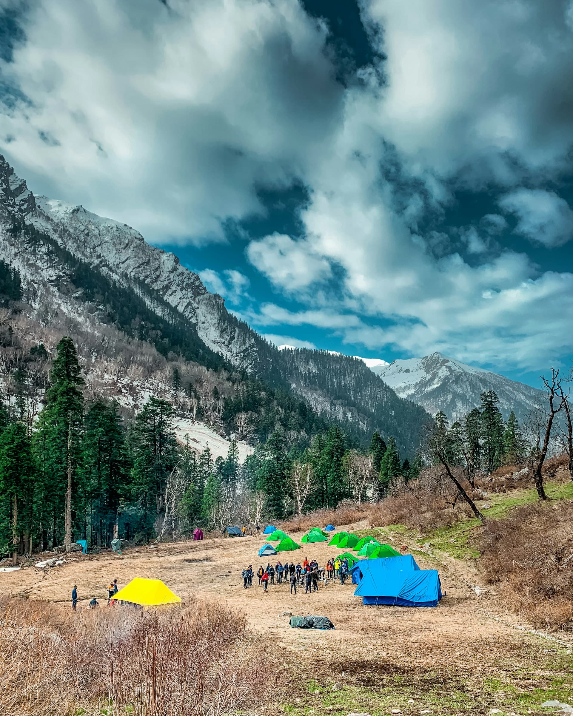
Har Ki Dun sits at 3,566m inside Govind Wildlife Sanctuary in the Garhwal Himalayas, and I think it is one of the most underrated walks in Uttarakhand. It does not appear in the same breath as Kedarnath or even Chopta, but the valley itself is more dramatic than both in certain ways - a wide, glacier-walled floor that opens up suddenly after hours of forest trail, with almost no one else around on most days.
From Dehradun, Sankri (the base village at 1,920m) is 180 km by road. The drive takes 5-6 hours on a clear day. There is no technical climbing, no rope work, and no specialized fitness requirement beyond basic trail readiness. That combination - driveable from Dehradun, non-technical, genuinely remote-feeling valley - makes it worth a proper look if you have not been.
This page covers the full route, every camp stage, permit procedure, the 5-day and 6-day itinerary options, side trips including Maninda Lake, what to expect in each season, and the practical details (cash, signals, accommodation) that actually matter on the ground.
Getting to Sankri from Dehradun
Sankri is 180 km from Dehradun via the Mussoorie-Purola-Mori road. The route runs through Mussoorie (32 km), then continues northeast through Kempty, Nainbag, Purola, Mori, and finally Sankri. On good road conditions with no major delays, the drive takes 5-6 hours.
I left Dehradun at 4 AM on my last trip up and reached Sankri at 9:30 AM. The road past Purola narrows considerably - in several stretches, two vehicles coming from opposite directions have to slow to a crawl and edge past each other. If you are driving yourself, this is the section that demands attention, especially in the dark or in rain. The road is paved throughout but takes some hard turns after Naugaon.
There is no direct bus from Dehradun to Sankri. The connection works like this: take a bus or shared vehicle to Purola or Barkot, then pick up a shared sumo or jeep onward to Sankri. Seat rates from Purola to Sankri run Rs 300-400. Shared jeeps depart early morning (around 6-7 AM from Purola) and may not have another service until the next day. Private cab hire from Dehradun to Sankri costs approximately Rs 3,000-4,500 depending on the vehicle and season.
ATM alert: there are no ATMs beyond Purola, which is about 90 km short of Sankri. Carry all the cash you need from Dehradun, Mussoorie, or Purola. Card payment is not an option anywhere on the trek. See the atm-cash-guide for the full picture.
Permits and Forest Department registration
Har Ki Dun sits inside Govind Wildlife Sanctuary, which means a permit is mandatory before you start. The Forest Department office is at Sankri, and you must register here before Day 2 begins.
The current permit fee is approximately Rs 150-200 per person per day inside the sanctuary. For a standard 3-4 day trek inside the sanctuary boundaries, budget Rs 600-800 per person just for the permit. A separate photography permit costs approximately Rs 500.
The registration process at Sankri is straightforward: show your ID proof (Aadhaar card works), declare the number of days and your planned route, pay the fee, and get a receipt. Keep this receipt with you throughout the trek. Forest checkposts at Taluka and beyond may ask to see it.
You can also register at the Uttarakhand Forest Department's online portal (forest.uk.gov.in) before your trip, though the physical registration at Sankri is still required. For trekking registration in Uttarakhand, the Nirjhari portal handles some routes - check whether Har Ki Dun requires it at the time of your visit as requirements have been updated periodically in 2025-2026.
The route - stage by stage
Sankri to Taluka (11 km, motorable): Taluka sits at 2,440m and is the last point vehicles can reach. From Sankri, this 11 km stretch runs along a jeep road. You can either walk the entire thing (roughly 3-4 hours) or hire a local jeep to Taluka, which costs around Rs 1,000-1,500 for a vehicle (shared among the group). Most trekkers take the jeep to save energy for the actual trail beyond Taluka.
Taluka to Seema (10 km, 4-5 hours): the trail starts properly at Taluka. The path climbs through dense oak and rhododendron forest, following the Tons River valley. The forest here is thick enough that sunlight hits the ground only in patches during much of the day. The trail crosses a few wooden bridges over side streams.
Seema sits at 2,720m and has basic accommodation options. There is a forest checkpost here where permits are checked again. Most trekkers doing the 6-day itinerary end Day 2 at Seema. On the 5-day plan, some people push through Seema to Osla on the same day, which works if you start Taluka early enough.
Water is available from streams along this section - treat before drinking. I carry a UV purifier on this trail specifically because the streams come down from glaciated ground and look clean but may not be.
Seema to Osla (4 km, 1.5 hours): this short section descends into the Tons River valley. The drop from Seema (2,720m) to Osla (2,565m) is noticeable but the trail is clear and not steep. Osla is a traditional Garhwali village of about 50-60 households, and this is where the trail gets culturally interesting.
The Duryodhana Temple at Osla is one of the more unusual things I have come across on a trek. The Mahabharat character Duryodhana, typically cast as the villain in the epic, is venerated here as a deity. The temple is modest in size but the idol is distinctive. The caretaker is a village elder who keeps irregular hours. When I was there, the temple was locked in the mid-afternoon. I spent about 20 minutes asking around before someone walked me to the caretaker's house three lanes away. He came, unlocked it, and explained briefly that Duryodhana is respected here as a king and provider. It is the kind of context you do not get from a sign or a pamphlet.
Osla has homestays - basic rooms, local food, and genuinely warm hospitality. Rates run Rs 400-600 per person including meals.
Osla to Har Ki Dun (10 km, 4-5 hours): the full valley approach. The trail climbs steadily through alpine meadows (bugyals) after the first few kilometres. The gradient is moderate throughout, nothing technical. What changes dramatically is the landscape at around the 8 km mark from Osla - the valley floor begins to widen and the walls on either side are glaciated, with Swargarohini peak (6,252m) visible to the northwest.
The last 2 km into Har Ki Dun valley are the ones I remember most clearly. The mountains flatten out to the horizon, the ground opens into a wide grassy bowl at 3,566m, and it genuinely looks like someone planned it. Glaciers on three sides, the Tons River originating here, and on a clear day almost no other trekkers visible.
5-day vs 6-day itinerary
The 5-day version is doable if you are comfortable with long days and use the Sankri-Taluka jeep. The 6-day version is more relaxed, splits Day 2 into two shorter stages, and gives you better recovery time at altitude.
5-day plan: Day 1 Dehradun to Sankri drive (180 km, 5-6 hrs). Day 2 Sankri to Seema (jeep to Taluka + trek, 11 km jeep + 10 km trek). Day 3 Seema to Har Ki Dun via Osla (14 km, 5-6 hrs). Day 4 Day hike in valley with Maninda Lake option (12 km round trip). Day 5 Full return Har Ki Dun to Sankri, drive out (24 km, start by 5 AM).
6-day plan: Day 1 Dehradun to Sankri drive. Day 2 Sankri to Taluka (jeep) + short hike, overnight Taluka/Seema (11 km jeep + 4 km). Day 3 Seema to Osla then Har Ki Dun (14 km, 5-6 hrs). Day 4 Day hike in valley (Maninda Lake option, 12 km round trip). Day 5 Return Har Ki Dun to Osla/Seema (14 km). Day 6 Seema/Taluka to Sankri, drive out (10-21 km).
The 5-day return (Day 5, Har Ki Dun to Sankri, 24 km) requires an early start - by 5:00 AM ideally - to be done before dark. The 6-day option converts that into two much more comfortable stages.
Side trips - Maninda Lake, Jaundhar Glacier, Bali Pass
Maninda Lake (4,100m): 6 km from the Har Ki Dun valley floor. A day hike that most people do on the rest day (Day 4). The round trip is approximately 12 km and takes 5-6 hours. The lake sits above the treeline at 4,100m in a glacial cirque. At altitude like this, acclimatization matters - the ascent from the valley floor (3,566m) to the lake (4,100m) is a 534m gain in one push. Read through the acclimatize-above-3000m guide before committing to this side trip. Start before 7 AM. Cloud cover builds in the valley from midday in most seasons and the path is unclear in poor visibility.
Jaundhar Glacier: the Jaundhar Glacier is visible from the valley floor and can be approached more closely by experienced trekkers who know glacier terrain. This is not a casual add-on - glacial travel requires appropriate footwear and awareness of crevasse risk. For most trekkers on this route, the view from the valley is sufficient and the approach should not be attempted without a local guide who knows current glacier conditions.
Bali Pass (5,500m): Bali Pass connects the Har Ki Dun valley to the Yamunotri valley on the other side. A technical crossing at 5,500m that requires ice axe, crampons, and experience with high-altitude snow routes. This is not an add-on for a standard Har Ki Dun trip - it is a separate multi-day undertaking that uses Har Ki Dun as a starting point.
Sankri as a dual base - Rupin Pass: Sankri is worth knowing as more than just the Har Ki Dun trailhead. The village is also the base for the Rupin Pass trek, which goes in an entirely different direction from Har Ki Dun - northwest toward the Rupin River gorge and the 4,650m pass crossing. Rupin Pass is considered one of the most visually varied pass treks in India. The full trip from Sankri and back takes 8 days. A combined Har Ki Dun + Rupin Pass trip needs 12-15 days.
Accommodation - what is available
Sankri: this is the most developed accommodation point. Options include the PWD rest house (booking in advance is recommended), private guesthouses ranging Rs 400-800 per night, and camping grounds on the outskirts. Several small shops here stock basic provisions - biscuits, noodles, packaged snacks, torch batteries. Stock up here because nothing is available with any reliability beyond Osla.
Taluka: a few basic dhabas and limited sleeping options. Most people either pass through quickly or camp here. Primarily a transition point.
Seema: Forest rest house (book through Forest Department at Sankri). Some camping is possible near the checkpost. Seema is not a village in the conventional sense - it is a collection of a few structures at the checkpoint.
Osla: the homestay experience here is genuinely good for a mountain village at this scale. Local food typically includes dal, rice, aloo sabzi, and roti. Rs 400-600 per person including dinner and breakfast. No menu, no choices - you eat what the household cooks, which is generally fine.
Har Ki Dun: GMVN (Garhwal Mandal Vikas Nigam) operates a hut in the valley that must be booked in advance through their reservation system. Rates approximately Rs 600-1,000 per night. There is a designated forest department camping zone near the hut. Several private trek operators also set up semi-permanent camps here in season (May-June and September-October) with pre-erected tents.
What to carry - gear for 3,566m valley camping
A 3,566m valley trek with overnight camping at altitude has specific gear requirements. The temperature at Har Ki Dun drops below 5C on most nights even in May and September. In October, night temperatures approach 0C.
For footwear, the trail has enough rocky sections and river-adjacent paths that a proper trekking shoe is required. Canvas or road running shoes are not appropriate. See trekking-shoes-under-5000 for tested options.
Layering is essential. The temperature difference between the Sankri drive (roughly 15-20C in May) and the Har Ki Dun valley floor (8-12C daytime, 2-5C night) is significant enough that unprepared trekkers consistently underestimate it. See thermals-high-altitude and jackets-kedarnath-trek for layering options.
Sleeping bags: at Har Ki Dun, a bag rated to -5C is the minimum for the October window. For May-June, -3C is workable on most nights. See sleeping-bags-spiti for tested options.
For your pack itself: a 45-50L bag is right for this trek. See backpacks-chopta-tungnath for sizing and weight distribution.
Other gear that regularly gets overlooked: headlamp (essential for the 5 AM starts on the return day - see headlamps-under-1000). Power bank (no charging point from Osla onward, a 20,000 mAh bank lasts most people 3-4 days with a phone, camera, and headlamp in rotation - see power-banks-trek). Rain gear (even in good months, the afternoon can bring brief showers at altitude - see rain-ponchos-char-dham). Full packing list for sustained altitude above 4,000m is in the packing-4000m guide.
Season-by-season breakdown
May to June: snow patches remain on the trail between Seema and Osla in early May, and the Maninda Lake route may be partially snow-covered. Rhododendrons bloom through much of this window, particularly on the Taluka-Seema section. Temperatures are pleasant on the trail (10-18C daytime at valley level) but nights are cold (2-6C at Har Ki Dun). Fewer trekkers than October. The risk is late-season snow that has not fully cleared on side trip routes.
July to August: monsoon season. The Tons River runs high and fast, some bridges become difficult or impassable, and the forest trail between Taluka and Seema accumulates leeches in large numbers. Landslide risk on the Purola-Sankri road is real - not a dealbreaker if you know the conditions, but the road can be blocked for hours. I avoid this window specifically. See the monsoon-routes guide for the full risk picture.
September to October: the best window for most trekkers. Monsoon clears by mid-September, visibility is at its best, and the valley floor grasses turn golden by October. Night temperatures drop toward 0C in late October, so sleeping bag rating matters. This is the busiest window, though busy here means encountering perhaps 10-20 other trekkers in the valley, not crowds.
November onward: the trail becomes snow-covered by November and most accommodation at Har Ki Dun shuts down. Not recommended without winter trekking experience and appropriate equipment.
Mobile signal, guides, and connections
Mobile signal: BSNL works in Sankri and has limited patchy coverage on the lower trail sections. Airtel and Jio drop out entirely by Taluka. From Taluka onward to Har Ki Dun, assume no mobile signal. If you need to communicate from the valley, a satellite communicator (Garmin inReach or similar) is the only reliable option. Tell someone your exact plan and expected return date before leaving Sankri. The GMVN hut may have a landline in season.
Guides and porters: the trail from Sankri to Har Ki Dun is well-marked and self-guided trekking is common. Route finding is not complex on the main Taluka-Seema-Osla-Har Ki Dun path. Where guides become useful is on the side trips: Maninda Lake trail is less clearly marked in sections, and the approach toward Jaundhar Glacier requires someone who has done it recently. Local guides are available in Sankri through guesthouses or the Forest Office. Daily rates run Rs 800-1,500 depending on experience and season. Porters charge Rs 600-1,000 per day for load carrying (typically capped at 15-20 kg per porter).
Connecting Har Ki Dun to a broader Uttarakhand trip: Har Ki Dun works well as a standalone trip from Dehradun. It also combines logically with Rupin Pass (same base village, completely different route, adds 8 days), Kedarnath (4-5 hours from Dehradun in the opposite direction, plan as separate trip), Chopta-Tungnath (the Kedarnath valley's western ridge, pairs with Har Ki Dun as two distinct Uttarakhand trekking experiences in one trip), or a Rishikesh stop (60 km from Dehradun, has good gear rental options, last point for cash and full connectivity).
When to go
What to pack
A full packing checklist is available to tick off and share. Start with these essentials, then adjust for the current forecast, route and your own needs: